About the UD SRS
History
The University of Delaware College of Earth Ocean and Environment's satellite receiving station (UD SRS) was installed on the roof of Willard Hall Education Building in July 2010. The equipment benefits faculty and others who study changes in the mid-Atlantic environment. It has supported a wide range of research projects, including those that monitor coastal flooding; observe coastal waters for harmful algal blooms, which can deprive waters of oxygen; and track changes in ocean circulation that could be related to climate change, and assisting local fisheries. The data produced from this equipment has also been utilized with Google Earth to aid in teaching and educational events.
The UD SRS was purchased with a grant from the National Oceanic and Atmospheric Administration (NOAA), obtained by CEOE Dean Nancy Targett. Since the installation of this equipment the receiving station has been drawn significant attention, with the first visible image of an chlorophyll(algal) bloom off the coast of New Jersey in August 2011. (Link: http://blogs.app.com/enviroguy/... NOTE: original article has been archived)
Station Overview
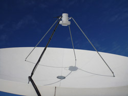
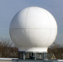
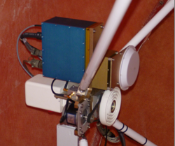
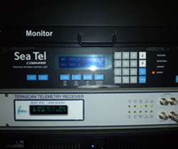
The station consists of an X-Band receiver for reception of the MODIS family of satellites which allows for the study of sea-surface temperature, chlorophyll concentrations, land surface temperatures, and vegetation patterns. An L-band receiver allows for the reception of NOAA, MetOP, and Fung-yen satellites to study atmospheric conditions, land surface temperatures, and sea surface temperatures.
The equipment, located on the roof of the Willard Hall Education Building, benefits faculty and others who study changes in the mid-Atlantic environment. It will support a wide range of research projects, including ones that monitor coastal flooding; observe coastal waters for harmful algal blooms, which can deprive waters of oxygen; and track changes in ocean circulation that could be related to climate change.
One of the receivers provides information on land and ocean surface conditions such as sea-surface temperature, chlorophyll concentration, and currents, while the other focuses on atmospheric and weather changes such as tropical storm activity and temperatures.
The stations cost about $500,000. A National Oceanic and Atmospheric Administration (NOAA) grant obtained by CEOE Dean Nancy Targett funded them.
From their perch atop the Willard Hall Education Building -- chosen because it allows a 360-degree view of the horizon with no electromagnetic interference -- the receivers collect information on a large swath of the globe. They capture data on the middle of the Atlantic to the center of North America and from Cuba to Newfoundland.


